PHOTOS: Southern Alberta slammed by damaging storms, tornado sightings

Saturday featured multiple rounds of severe thunderstorms, with the more potent cells bringing destructive hail, flash floods, strong winds, funnel clouds and unconfirmed tornado sightings in the late afternoon and evening.
Southern Alberta saw several rounds of severe weather last Friday and Saturday when intense thunderstorms tracked through.
After early-morning storms weakened and moved out on Saturday, the activity picked up in the late afternoon with thunderstorm watches and warnings. It wasn't long before storms intensified and prompted the first batch of tornado warnings at approximately 7:30 MDT, which were issued over a two-hour period.
RELATED: IN PHOTOS: Scary Alberta skies as powerful storms crackle to life
It was mainly two cells that prompted the warning for multiple counties during the two hours they were in place, including those surrounding Lethbridge and the Vauxhall area, near Taber, as well as up towards Brooks.
On June 17 Environment Canada confirmed a tornado that touched down near Barnwell on June 13. The preliminary storm assessment states that it occurred at 7:58 p.m. MDT roughly 10 km south of Barnwell and has a preliminary rating of EF-0. Environment Canada is collaborating with the Northern Tornadoes Project and is working to determine a path for this tornado.
Environment Canada's statement also confirms that a possible tornado in Calgary on the evening on June 13 was a funnel cloud, not a tornado. Photos of these events and any damage are being collected and Environment Canada notes that their storm assessments are preliminary and could change if more information becomes available.
SIGHTS FROM ROUND 2 OF SATURDAY STORMS
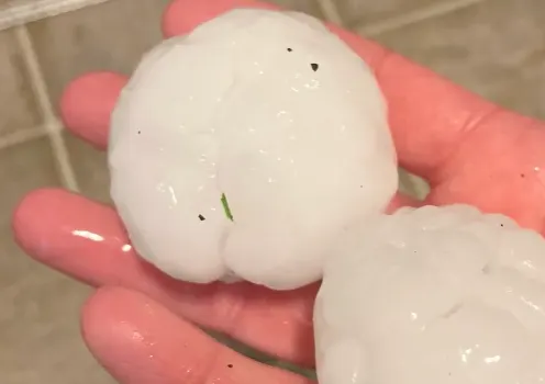
Cities such as Calgary were slammed by large hail, which caused damaged to cars and homes, as well as flash floods from heavy downpours. There were also unconfirmed reports of winds exceeding 100 km/h in some locales.
“There was not a vehicle left outside in Martindale and Taradale that probably wasn’t destroyed. I don’t think we’re talking about damage in the millions, I think we’re probably talking in the hundreds of millions. Maybe even a billion dollars worth of damage," said Ward 5 Coun. George Chahal during a press conference on Monday.
It didn't take long before social media was lit up by photos and videos of the storms' impacts, including scenes of flash floods, damaged windshields and houses from large hail, funnel clouds, supercells and possible tornado sightings.
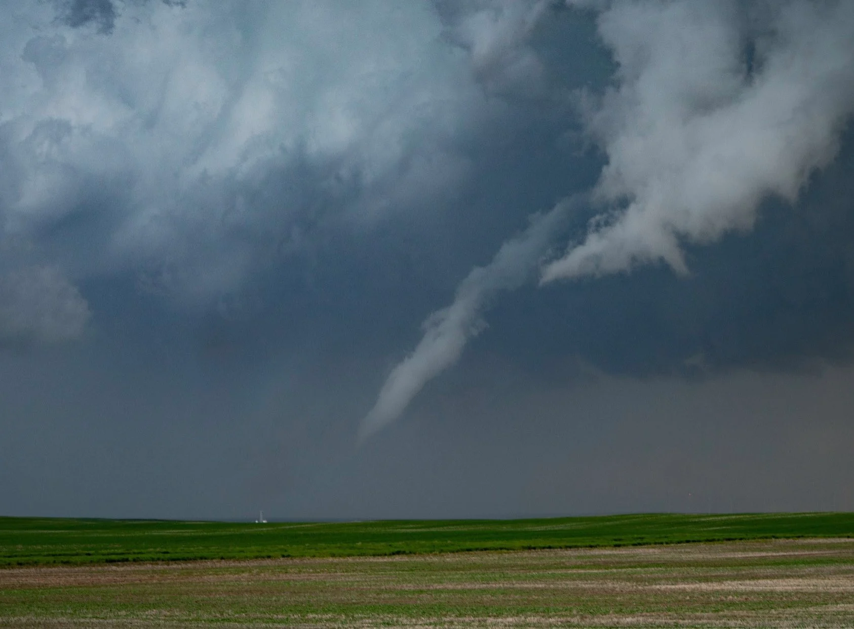
Funnel cloud south of Chin, Alta., Saturday evening. Photo: Kyle Brittain.