Fascinating funnel cloud spotted in Vancouver

Reports of a funnel cloud near Vancouver International Airport surfaced on social media on May 12.
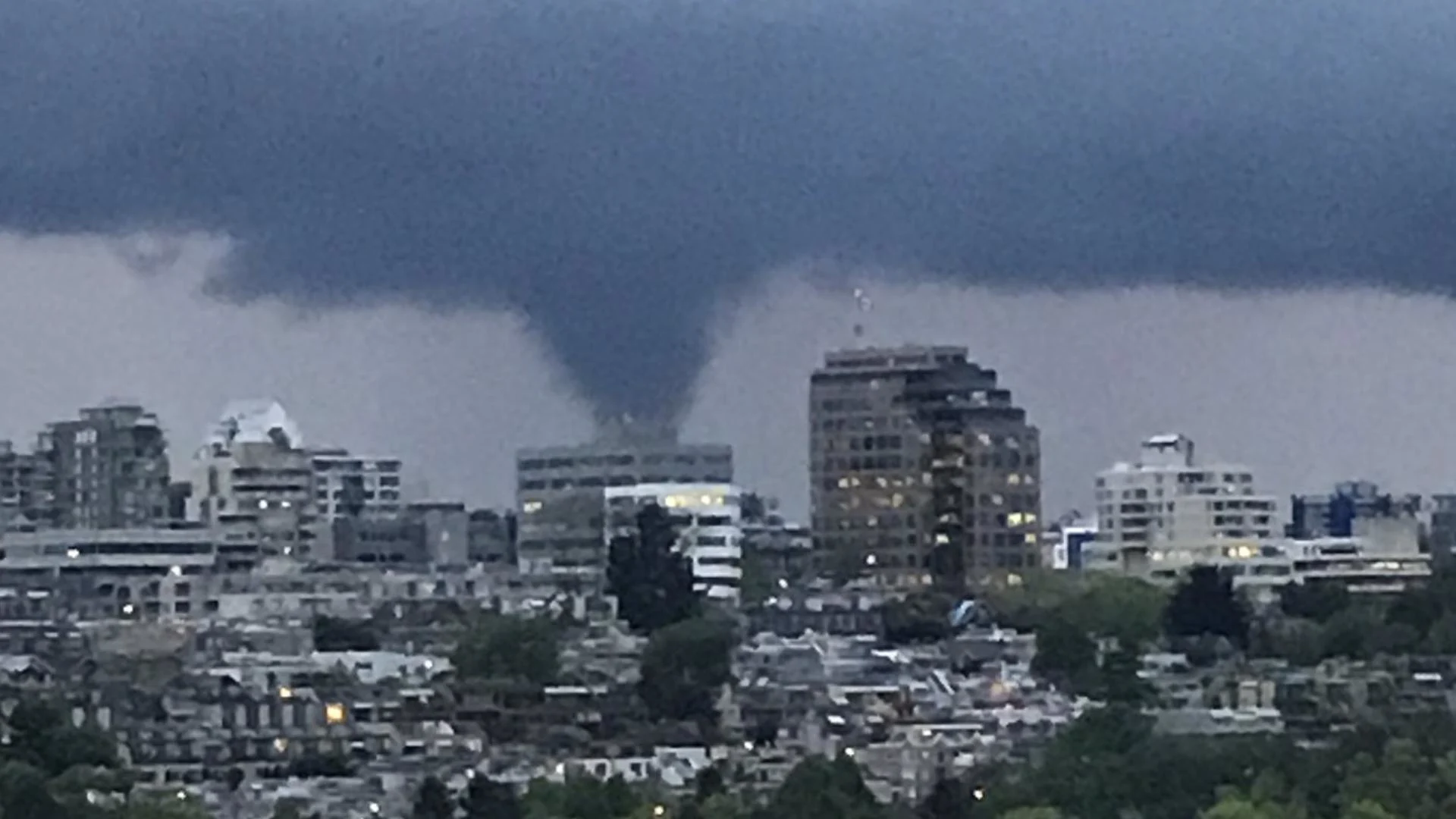
To the envy of numerous storm enthusiasts across Canada, one of the most unsuspecting places in Canada delivered a funnel cloud Tuesday evening.
The atmospheric setup was quite anemic, lacking the tell-tale signs of significant convection. Modest instability was in place, enough to spark off some sporadic storms, but nothing too out of the ordinary.
TUESDAY AFTERNOON SETUP
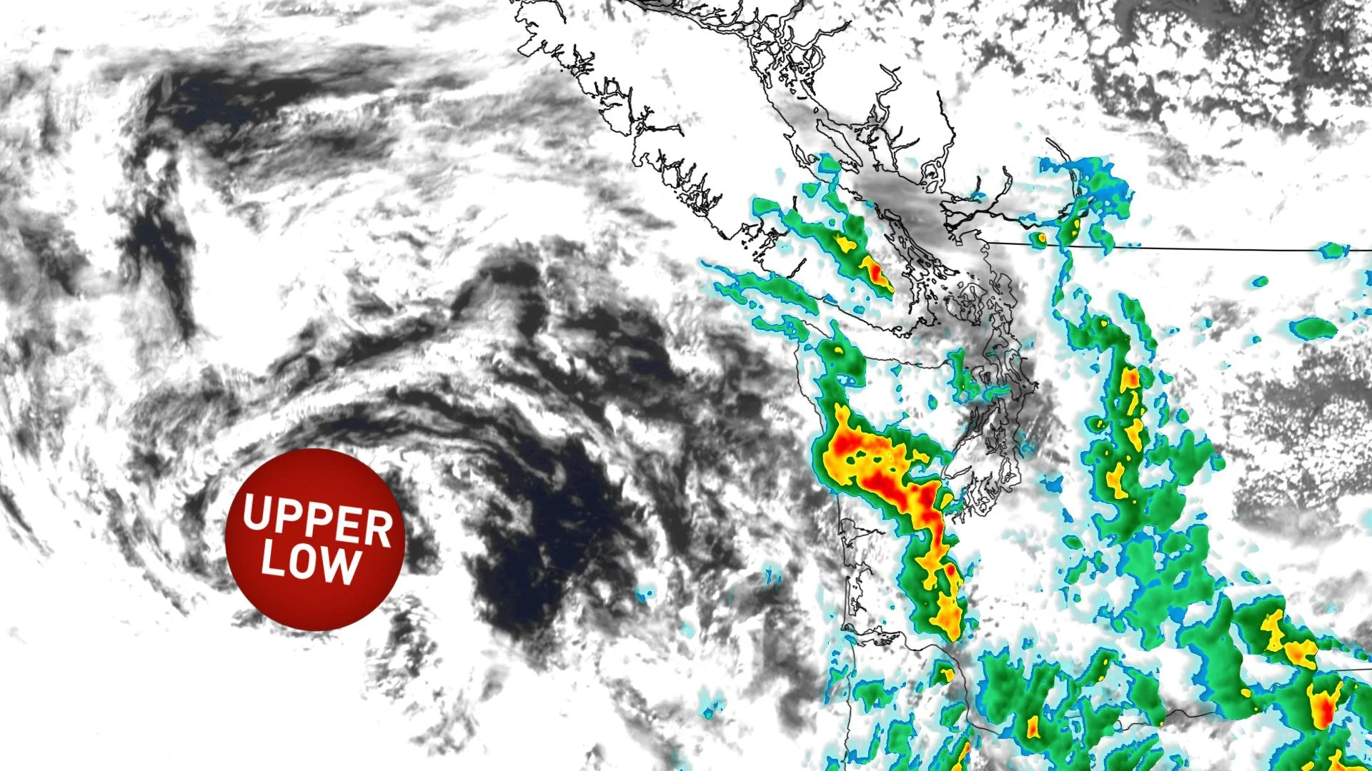
An upper low sat well southwest of Vancouver Island with some convective showers propagating across parts of Vancouver Island and the Fraser Valley.
8:30 PM PT TUESDAY
Right between a stable marine layer and some residual surface instability inland, a fairly impressive thunderstorm cell developed near Vancouver International Airport.
Images on social media started to circulate approximately 20 minutes before sunset that showed a prominent funnel cloud descending from a fairly well-defined thunderstorm.
After consultation with other meteorologists, it’s possible that this was a supercell in disguise.
Although it’s possible this was a weak mesocyclone, which is a fancy term for a rotating thunderstorm, another explanation is more likely.
The storm appeared to feature a classic wall-cloud along with a clearly defined cloud base, but other severe weather parameters didn’t seem to line up in the environment to support a supercell.
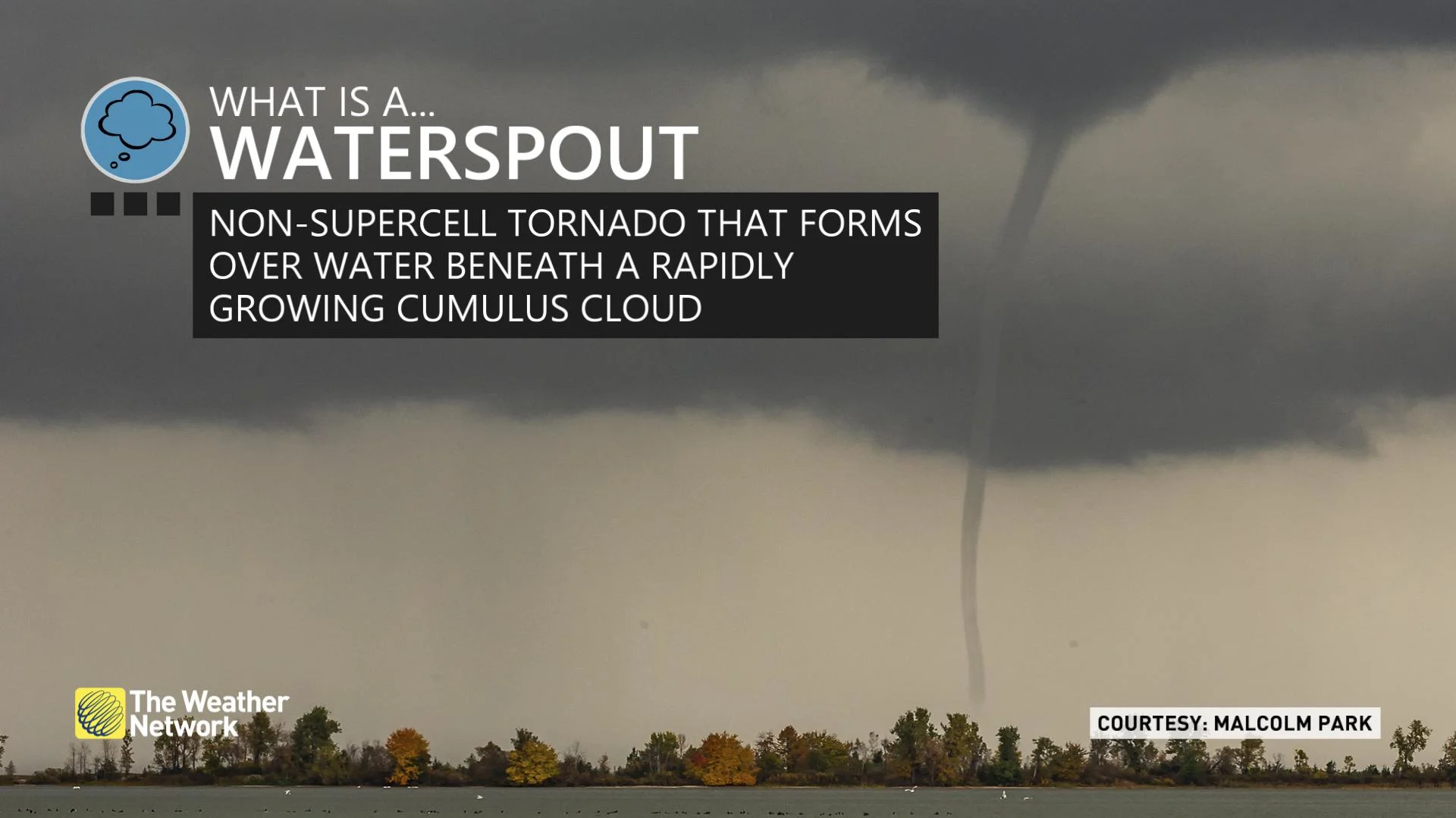
Non-supercell tornadoes can occasionally develop in the region, especially with cold air aloft paired with low-level instability. These often manifest themselves as waterspouts across the South Coast.
Rotation can initiate below the developing updraft itself. In this case, low-level convergence continues to 'tighten up' as the thunderstorm grows vertically into the sky.
Note: This article previously identified this as a weak mesocyclone, which was incorrect. The article has now been updated with the correct information.


